

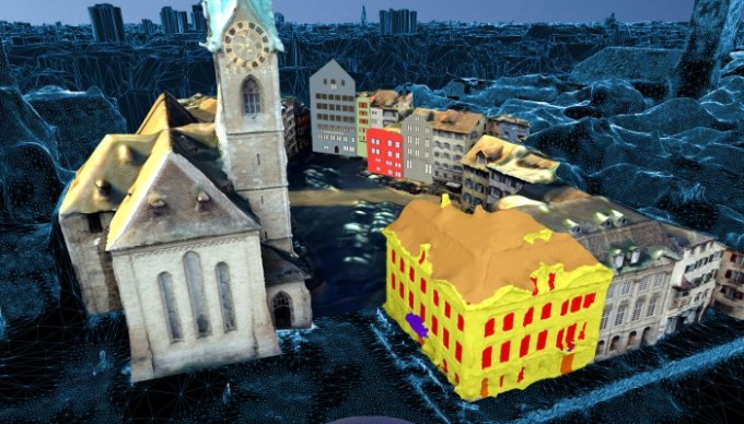
 People are taking photos and videos all over major cities, all the time, from every angle. Theoretically, with enough of them, you could map every street and building — wait, did I say theoretically? I meant in practice, as the VarCity project has demonstrated with Zurich, Switzerland. Read More
Source: Tech Crunch